
CTA Centennial Part 6c: Platform Wars – Airways (Part I)
The platform wars continue in the sky above...

This year marks the 100th anniversary of the founding of the CTA (Consumer Technology Association), which started out as the RMA (Radio Manufacturers Association). This is the fifth in a series of essays exploring and celebrating CTA’s and our industry’s first century of invention, innovation, and entrepreneurship, assembled from varying technology historical research and writings I have done over the course of 20-plus years, including from an annually updated industry history for CTA’s now-defunct Digital America, 20-plus years of CTA Hall of Fame inductee biographies, and numerous tech history articles for a variety of publications over the years.
Here are the previous chapters:
- Part 1 (1924-1929): Founding
- Herbert H. Frost: CTA’s “George Washington”
- Part 2 (1930-1945): David Sarnoff
- Part 3 (1946-1960): The TV Age
- Part 4 (1961-1974): The Sixties
- Jack Wayman, Our Industry’s Indispensable Exec
- Part 5a (1975-1985): Decade of Disruption – Home Video
- Part 5b (1975-1985): Decade of Disruption – Personal Audio
- Part 5c (1975-1985): Decade of Disruption – Personal Computing
- Part 5d (1975-1985): A Decade of Disruption – 1984 Phones It In
- Part 5e (1975-1985): A Decade of Disruption – 1984, The Sony Decision
- Part 6a (1985-2000): Platform Wars – Recording Media
- Part 6b (1985-2000): Platform Wars – Video Games
While platform wars during the late 1980s and 1990s were a natural result of competing hardware companies battling to establish lucrative physical technology formats, multiple platform wars erupted in the airwaves, including in the still-new cellular phone and satellite services. So many important and far-reaching airways platform wars broke out during this period that it’ll take two installments to cover them all.
First came the cellular platform wars…
Considering the prohibitive cost of hardware and service, cellular carriers were taken by surprise by the high consumer demand both business-wise and technically. Technically, analog cellular systems were soon overwhelmed by the unexpected customer deluge and high volume of cellular phone usage.
In 1989, the digital Time Division Multiple Access (TDMA) system was established. When finally introduced in 1992, TDMA tripled capacity and vastly improved sound quality. In July 1993, an alternative digital standard, Code Division Multiple Access (CDMA) technology was introduced by a relatively new telecom company, Qualcomm.
Qualcomm
 At the time, Qualcomm was a largely unknown company but has obviously grown into one of our industry’s major technology players. Unlike the relatively well-known backstories of today’s tech giants Apple, Amazon, Facebook, Google, Intel, et al, I doubt most know the origins of one of the world’s most prolific suppliers of the most important component in modern tech – microchips.
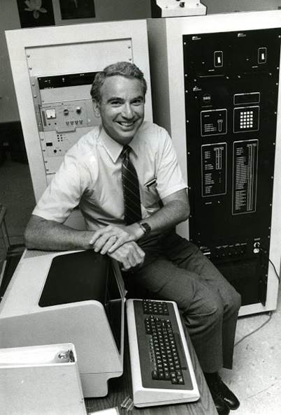
Not only did the initial creation of Qualcomm have nothing to do with chips, but the company’s primary founder, Dr. Irwin Jacobs, was a retiree.
Born in New Bedford, MA, on 18 October 1933, Jacobs, like many technology innovators, was a tinkerer as a child, his adolescent years filled with assembling varying contraptions out of milk bottles, lights, and electric motors. A high school chemistry and math teacher further stoked Jacobs’ interest in science. A photography buff, Jacobs also earned money and learned about entrepreneurship by developing film in a makeshift darkroom at his family’s home.
When he got to Cornell University, Jacobs originally majored in hotel administration before switching his major to engineering. He received a bachelor’s degree in electrical engineering in 1956 from Cornell, a master’s in science in 1957, and a Doctor of Science degree in electrical engineering from MIT in 1959. After graduation, Jacobs was hired as an assistant/associate professor of electrical engineering at MIT, where he co-authored a basic but long-deployed textbook on digital communications, “Principles of Communication Engineering.” From 1966 to 1972 Jacobs taught computer science and engineering at the University of California, San Diego.
In Los Angeles in mid-1968, while still teaching, Jacobs, along with Andrew Viterbi and internet pioneer Leonard Kleinrock, formed Linkabit, a communications technology consulting company that worked primarily on government defense communications. Linkabit started as a once-a-week consulting company, but after a few months, it was clear the company required more attention after the introduction of the first Ku-band Very Small Aperture Earth Terminals (VSATs), commercial TDMA wireless phones, and the VideoCipher satellite-to-home TV system.

When Linkabit grew from a few part-timers to more than 1,000 employees, Jacobs quit his teaching job for full-time corporate life and spent the next decade-plus running and growing Linkabit. In August 1980, Linkabit was sold for $25 million, and Jacobs served on the merged company’s board of directors. In April 1985, Jacobs retired.
His retirement was short-lived. On 1 July 1985, 20 months after the first cellphone networks went live, Jacobs convened a meeting with six former Linkabit employees – Viterbi, Franklin Antonio, Adelia Coffman, Andrew Cohen, Klein Gilhousen, and Harvey White – in the den of his San Diego home. The group decided to build a “QUALity COMMunications” company. Jacobs became chairman and CEO of the new Qualcomm.
Initially, the company started out providing contract research and development services, with limited product manufacturing, for the wireless telecommunications market. One of Qualcomm’s first goals was to develop a commercial product, which eventually resulted in the Omnitracs tracking system for trucks. Since its introduction, Omnitracs has grown into one of, if not the largest tracking and communications systems for the commercial trucking and logistics industry.
Heading home from a consulting job in 1985, it dawned on Jacobs that a World War II technology developed by screen siren Hedy Lamarr and music composer George Antheil based on Nikola Tesla’s frequency hopping concept, which postulated that multiple frequencies could be used to send a single radio transmission, could be used to create more secure cellular communications. He asked Qualcomm co-founder Klein Gilhousen, who was driving the car, to explore and develop the idea.
Three months after the Telecommunications Industry Association (TIA) endorsed TDMA, Qualcomm introduced the result of Jacobs’ brainstorm and the Gilhousen-led development. Initially, Qualcomm’s CDMA was dismissed as inferior to TDMA and, for a few years, CDMA-based carriers battled with more dominant TDMA carriers.
GSM
 Cellular network development wasn’t restricted to the U.S. Work began in 1983 on a European digital cellular system initially called Groupe Spécial Mobile, or GSM, which was officially adopted by the European Union in 1987. The GSM acronym would eventually evolve to stand for Global System for Mobile.
While GSM was being developed, so was a text message standard called Short Message Service, or SMS, first conceived by Deutsche Telekom’s Freidhelm Hillebrand and then developed by France Télécom’s Bernard Ghillebraert as part of the GSM system. The first text message was sent on December 3, 1992, when 22-year-old test engineer Neil Papworth, developing an SMS center in England, typed “Merry Christmas” on his PC and then sent the message to Vodafone director Richard Jarvis via the U.K.’s Vodafone network.

In December 1994, the FCC began to auction off the 1900 MHz so-called “PCS” (Personal Communications Service) bands for digital CDMA and GSM cellphone use. The following year, the first 1900 MHz networks were launched in the U.S.
CDMA phones proved to provide better voice clarity and higher security than TDMA. Used by Verizon and Sprint in the U.S., CDMA soon became the dominant alternative to GSM, adopted by AT&T and T-Mobile (then known as VoiceStream), and TDMA disappeared. Through most of the late 1990s and early 2000s, however, consumers continued to be confused by competing cellular acronyms, device-carrier-network compatibility questions, and wireless data capabilities in both networks and devices. I expended way too much of my professional and personal time trying to explain these varying cellular differences to readers, viewers, friends, and family.

By 1996, thanks to single-chip digital signal processing (DSP) chips first unveiled in 1983 by Texas Instruments, cellular phones became pocket-sized and “wearable,” led by the seemingly impossibly tiny 3.1-ounce Motorola StarTAC, introduced at the 1996 Winter CES. Every major carrier was soon offering digital PCS data service, which allowed a raft of text messaging and information services and features to be accessed via text menus on larger LCD screens built into increasingly shrinking candybar and clamshell portable phones.
Of course, none of these tiny phones included QWERTY keyboards. You were forced to use the phone’s usually tiny alphanumeric dial pad to navigate menus and compose text messages – press “4” twice to get an “H”, press “3” twice to get an “E”, press “5” three times to get an “L”, pause, press “5” three more times to get another “L”, press “6” three times to get an “O”, etc. – an awkward, time-consuming, and frustrating process. As a result, text messaging, while innovative, was more of a last-resort mobile communication method. Fortunately, you could still use these new data-capable cell phones to make voice calls.
In the late 2010s, Verizon and Sprint finally adopted GSM with the advent of 4G LTE, although both carriers retained their CDMA networks for legacy non-LTE devices. But while the establishment of GSM would finally settle the cellular network format war, new wireless data cellphone platform battles would emerge early in the new century.
Look, Up in the Sky…

While the terrestrial cellular wireless data format battles were playing out, several wireless communications platform battles were playing out in orbit.
In 1945, Arthur C. Clarke was an RAF electronics officer and member of the British Interplanetary Society. In an article he wrote for Wireless World magazine that year entitled “Extra-Terrestrial Relays,” Clarke, who would go on to write 2001: A Space Odyssey and many other science-fiction classics more than 30 years later, proposed that a series of satellites orbiting the earth could be used to distribute TV programs. The area of space 22,300 miles above the Earth where satellites now orbit the Earth is called the Clarke Belt in his honor.
However, satellite television wouldn’t be the first consumer use of satellite technology.
Half the distance closer than the Clarke Belt – around 12,550 miles over our heads – is where all the Global Positioning System (GPS) satellites orbit twice a day. In previous chapters, I alluded to GPS. Now is a good time to bring us up to date on the technology that, in the late 1990s, started to kill the map industry and quieted the demand of companions of lost drivers to stop and ask directions.
While we think of GPS today as a single standard (albeit different systems in different parts of the world), it started out as a platform war, pitting military vs. commercial interests just as radio and the internet did.

Every school child knows (or should…) that the first artificial man-made object launched into orbit was Sputnik by the Soviet Union in 1957. Notwithstanding Clarke’s more foresighted TV transmission vision, satellites were perceived by the public as largely military, commercial, or industrial technology used for space photography, weather, radar navigation, and tracking of aircraft.
While working for MIT’s Division of Fire Control and Army Radar, Ivan Getting led a team that developed tracking radar that helped the Allies destroy 95 percent of the V-1 rockets Germany launched at England in the waning days of World War II. After the war and during the early heady days of Sputnik, Getting, now VP of research at Raytheon, promoted the idea of using satellites to track individual moving objects on the ground.
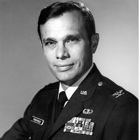
By the early 1970s, it was clear aspects of the Getting’s original GPS plan were technically unfeasible. Several competing ideas emerged, and the battling projects caused military paralysis until a serendipitous weekend meeting in November 1972 between the third in command at the Department of Defense, Dr. Malcolm R. Currie, a fan of the project, and an equally enthusiastic 37-year-old Air Force colonel and MIT and Stanford graduate named Dr. Bradford Parkinson. After four hours, the bureaucrat decided to help the officer resurrect the Air Force GPS proposal.
Since GPS was a military project, Parkinson still had hierarchical, political, plus the usual technical hurdles to overcome. In August 1973, a defense review council voted to end the project. In a meeting immediately after the vote, Currie convinced Parkinson to reconstitute GPS as a joint military services project.
Over the Labor Day weekend, Parkinson holed up with a dozen like-minded engineers from the varying military branches and several universities at the Pentagon. On Monday morning, the group produced a seven-page joint paper, nearly starting from scratch but describing what would eventually become the GPS system.
Parkinson spent the next three months on the road to convince the powers that be. In December 1973, the same defense review council that had turned Parkinson down four months previously this time gave him the go-ahead. By 1978, after surviving several attempts to kill the project, Parkinson’s confidence paid off. After the successful launch of the first Navigation System with Timing and Ranging – NAVSTAR – GPS satellites, starting with the first on February 22, 1978, Parkinson left the military but remains recognized today as the father of GPS.
To discourage potential enemies of the U.S. from using the system for nefarious purposes, a Selective Availability (SA) degradation was imposed on the system. SA’s purposeful inaccuracy and GPS’ classified nature also discouraged consumer development.
This changed in September 1983 when the Soviets shot down Korea Air Flight 007. In the wake of this tragedy, President Ronald Reagan issued a directive to declassify GPS and encourage its commercial development in the hopes of averting similar aviation disasters in the future.
Finally a public technology, Reagan’s GPS commercialization gauntlet was picked by serial entrepreneur and pilot Ed Tuck, who wanted a mobile GPS device priced at less than $300 that could tell him where he was while he was flying. Tuck recruited Don Rea and Norm Hunt, who co-ran Omicron Labs, a small Santa Ana, CA, electronic navigation engineering consulting firm. The pair had successfully tracked five of the six working GPS satellites for six hours, making them relative experts in the newly declassified system. In April 1986, the trio founded Magellan, adding programmers, electrical, and chip engineers over the next four years.

However, the drive to create a portable GPS device stalled after the explosion of the Space Shuttle Challenger, which delayed the shuttle launches due to carrying additional GPS satellites into orbit for three years. However, Magellan’s crew – minus Hunt, who had died in late 1985 – continued to work. In May 1989, started to sell its NAV 1000, the world’s first commercial handheld GPS receiver.
On August 2, 1990, the ninth GPS satellite made it into orbit – the same day Iraq invaded Kuwait and ignited the first Gulf War. By the time the U.S. invaded Kuwait and then Iraq in early 1991, there were 16 working GPS satellites circling overhead, providing coverage 19 hours a day.
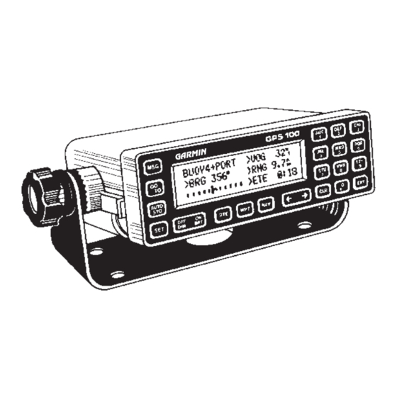
Magellan’s NAV 1000 was followed in October 1992 by the Garmin GPS 100 Personal Navigator, a $2,500 dashboard-mounted GPS navigation receiver for boaters. By 1993, the full complement of 24 GPS satellites would be in orbit, providing nationwide coverage 24/7. After the success of Magellan and Garmin, other GPS devices from other companies such as TomTom (1991) and Mio (2002) hit the market, using maps and navigation software from a variety of suppliers such as Navteq (1987), Navigon (1991), SiRF (1995), and TeleNav (1999).
Even with SA limitations, the technology’s success on the Kuwait and Iraq battlefields made GPS the must-have gadget for drivers, hikers, and boaters. On May 1, 2000, President Bill Clinton turned off the SA restrictions, which improved consumer device accuracy to 15 feet, coincidentally around the same time the first handheld units that included city street maps became available.
Handheld, car and marine GPS devices proliferated in the first decade of the new century. As of July 2023, there were 31 U.S. GPS satellites in orbit, and a continual replacement/enhancement plan is in place. But all standalone consumer GPS gear would soon be usurped by a more all-encompassing device.
In Part II, we’ll explore the other airway platform wars involving satellite TV and radio.
See also: CTA Centennial Part 6b (1985-2000): Platform Wars – Video Games